Long Distance Trails – Ridge and Valley Trail


NEW YORK/PHILADELPHIA METROPOLITAN AREA
OPEN SPACE RESOURCE LIBRARY
Ridge and Valley Trail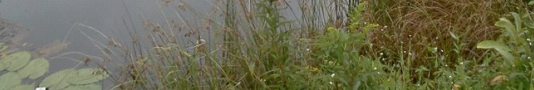
This outstanding trail is named for the geographical province through which it crosses, the Ridge and Valley. Most noted for the beautiful Kittatinny Ridge, the lower portion of this province is usually overshadowed by it and the controvercial Highlands province to the south. It is fortunate that excellent non profit organizations like the Ridge and Valley Conservancy under guidance of Bob Canase have been able to preserve the amazing natural resources the land has to offer, as well as design a series of trails to showcase it's features.
The Ridge and Valley Trail has several different legs, the main one intended to connect the Paulins Kill Valley Trail with the Appalachian Trail. Much of the trail is still under development, but the existing sections are well worth the visit.
When I first discovered the Ridge and Valley Trail in 2005, I was impressed at how very natural it was. Where some maintainers go to great efforts to grade trails, and go overboard cutting back vegetation, the Ridge and Valley Trail proudly navigates the challenging terrain, often with little more than it's slate markers to guide the way. Bob Canase designed the Ridge and Valley Trail marker to depict the ridge and valley in an abstract symbol of the Delaware Water Gap. He even used to make the markers himself in his basement. Slate is used to keep with the natural theme of the trail, it being an element that occurs in the region.
0.00 - The trail begins at the Paulins Kill Valley Trail in Marksboro where there is parking. There are currently no markers here. To begin on the trail, turn left and climb the hill on Spring Valley Road. Note on the right side of the road the former cut of the White Lake spur railroad that once serviced the industry along the lake. The widening of Spring Valley Road over the years has obliterated some of the right of way.
0.07 - Primrose Road turns off to the right. On this intersection, a small old roadway parallels Spring Valley Road, and is the route that should be walked.
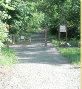
0.13 - Reach a parking area for White Lake Natural Resource Area. The trail enters the woods beyond a gate, and follows the abandoned railroad right of way that once led to White Lake. Outstanding views of wetlands can be seen to the right.
0.43 - The trail splits. To the left, the spur trail leads out to a dead end on a jetti along White Lake. Ridge and Valley Trail turns right and crosses the outlet of the lake to reach the Marl Works. In the 1880s, Marl, the limestone based sediment composed of ancient ground up shell fish, was dredged from the lake and processed here. It was then carried by rail line along the New York, Susquehanna, and Western Railroad, now Paulins Kill Valley Trail to Newark and Jersey City where it was used to neutralize their sewer systems. This was also the home to an industrial ice house complex in the days before refrigeration. The trail continues past the wall of the Marl Works into the woods.
- The trail reaches a large chimney, and a few foundations. This was once the dining hall to a girl scout camp. Many other fire places exist off trail along the shore of the lake in this vicinity. The trail continues on a level atop a small ridge above the lake.
- Ridge and Valley Trail turns sharply to the left, down hill to the low wetlands. It crosses in an area that can be seasonally wet.
- On the way up hill beyond the wetlands, pass an old lime kiln on the right. It's center section is beginning to collapse.
- After crossing a knoll, the trail turns right and continues to skirt the Natural Resource Area boundary. Blazes along the entire trail may be removed due to recurrent vandalism by adjacent land owners and hunters who like to use them for target practice.
- The trail becomes a woods road at a point where an old hunters cabin once stood. An illegal ATV access comes onto the property to the right.
- Blue blazed White Lake Trail turns left away from RV Trail across a small puncheon. It continues to the main parking area and the White Lake Barn area.
- The trail crosses Rt 521, Stillwater Road. It turns left immediately and follows a field, and then a farm access road parallel with Rt 521.
- Reach a parking area for White Lake Wildlife Management Area. The trail enters the woods again here, turns left and descends into a small valley. The trail may be re-routed in this area due to the amount of blow downs.
- The trail reaches the top of another small ridge, then descends with a field to the left. After passing the corner of the field, it passes through more woods.
- The trail climbs to the top of a small ridge and splits in two directions. The main trail turns left, while the other route turns right. Both are blazed the same, and both reach Sunset Lake Road.
RIGHT FORK, WHITE LAKE WMA TO LIMESTONE FOREST
- The trail follows the top fo the small ridge. Below the ridge, notice an old 1940s model truck sitting in the woods.
- The trail can be very difficult to follow in this area, as it passes through several ridges and valleys on it's way north. Watch very closely for the next blazes. It leaves White Lake WMA and enters Limestone Forest Preserve.
- The trail splits again at an obscure junction. To the right, the trail leads on a long route over ridges and valleys in very scenic terrain. To the left, the trail makes a shorter route over ridges and valleys and rejoins at the top of a wide, level ridge.
- From where the trail re-join, the trail remains difficult to follow, passing through one more little valley, climbing to the other side, then descending for a bit through a valley to a lower area. Homes will come into view ahead. The trail turns right and skirts the private lands.
- The trail crosses a driveway and continues through woods.
- The trail reaches the driveway again, and turns left to follow it.
- The trail reaches Sunset Lake Road at a private gate with a smashed mail box. There is a nice road walk that can be followed to reach Blair Creek Preserve by taking Sunset Lake Road to the right, then left on Millbrook-Stillwater Road, then right on Old Schoolhouse Road. A trail, which may be unmarked, turns off to the left near a power line.
MAIN FORK, LEFT, WHITE LAKE WMA
-
-The trail makes it's way through woods and follows an old field to the left. It can get very overgrown.
- The trail becomes very obscure as it makes it's way through tick barberries.
- The trail turns right with a cleared farm area off to the right in sight. Do not trespass.
- The trail crosses an access road, then climbs a very large steep section of ridge to the top. It continues to the right at the top of the ridge with seasonal views to the south.
- The trail descends along the ridge and turns left, then right again ascending a bit.
- At a small valley, the trail continues slightly to the right. Look for old messy paint blazes because hunters have removed many of the slate markers to keep hikers away while they are hunting.
- The trail continues down hill, and reaches Sunset Lake Road to the right. It may be rerouted to reach the road at a new parking area.
- Turn right on Sunset Lake Road. Blazes end here. The proposed route from here leads to the left onto Butler Road, a short dead end street, and enters Lightning Bug Hollow Preserve. It will then continue on to Princeton-Blairstown Center where blazed trail once again exists. It is currently a dead end trail south of Birch Ridge Road.
- Reach Birch Ridge Road and cross. The trail follows a wide path and turns left
- The trail crosses Shannon Road and enters Camp Mason property.
- The trail crosses Blair Creek on an amazing swinging rope bridge constructed by volunteers
-
-The trail turns right on an existing camp trail. Blazes end here.
-
-
The remainder of the route follows existing camp trails to the giant beaver meadow to the north. It crosses the dam of the meadow, then crosses a power line to the right. The proposed route follows a crudely paint blazed trail which leads from camp property onto Delaware Water Gap National Recreation Area property up hill to abandoned Sand Pond Road. It then turns left to the parking spot at Rick's Rocks on Millbrook-Blairstown Road, only a quarter mile south from the AT. This existing trail is not recognized by National Park Service, as it is not part of their "trails plan", and so permission has not yet been granted to allow the trail to connect. In addition, Appalachian Trail Conservancy feels that having another trail connect would increase traffic on the AT, though in reality it would probably relieve traffic. The trail may have to end at Ricks Rocks, which isn't a big deal.

Hosting courtesy of Firebrand Communications. Website design by SGF Studios
©2012 Metrotrails unless otherwise noted • All rights reserved