Long Distance Trails – Ogden Mine Railroad


NEW YORK/PHILADELPHIA METROPOLITAN AREA
OPEN SPACE RESOURCE LIBRARY

Ogden Mine Railroad
Although I started off tracing the routes of large, well known railroad lines, who's names boldly grace the pages of countless history books, and who's abandoned structures and well graded, double tracked rights of way are recognizable to even the novice enthusiast, my interest in obscure short lines has grown on me like the acquired taste of a fine wine.
The Ogden Mine Railroad is one such line. The broken remains of it's route tells a story of it's bustling past from the days of the canals to the fall of the industrial era. Tracing sections of it's route can be enjoyed by everyone from the casual walker out for an afternoon stroll, the determined historian looking for clues of it's former glory, or the intrepid hiker fighting to cover it's entire length.
The line was constructed from Sparta Mountain to Nolan's Point on Lake Hopatcong in 1866 to carry iron ore from the mines to barges for transport on the Morris Canal. Prior to the 1872 completion of the future New York, Susquehanna, and Western Railroad which served Sussex County towns to the west, Ogden Mine Railroad was also patronized by some of the zinc industry from nearby Ogdensburg, near Franklin which was known to be the zinc capitol of the world.
Naturally, the Ogden Mine Railroad suffered from the same limitations facing the Morris Canal; it had to be closed during winter months when the canal would freeze over. This all changed when in 1881 the rail line was leased to the Central Railroad of New Jersey. In 1882, CNJ opened the Lake Hopatcong Railroad, which connected the former Ogden Mine Railroad with CNJ's High Bridge Branch to the south at Lake Junction.
Unfortunately, even the promising iron industry here was short lived. The discovery of more accessible ore further west led to the decline and closure of the mines along the route. The great Thomas Edison, in one of his career failures tried to revive the mining industry (the village at the northern terminus even changed the name of their town from "Ogden" to "Edison" as a good gesture). Edison too was forced to close the mines in 1900.
The rail line lived on through use in passenger tourism, and by hauling ice from Lake Hopatcong for some time, but they too began to fade into obscurity. By the 1930s, serviced dwindled to almost nothing.
In 1941, the rails were torn up for war time scrap. In the years to follow, new developments and the construction of Rt 15 obliterated much of the center section of the right of way. The transfer docks and ice house industries which once graced the shores of Lake Hopatcong at Nolan's Point have given way to quiet bedroom communities and quiet, narrow single outlet streets which make even an auto tour for rail evidence difficult.
Fortunately, sections of the former rail bed have been preserved in Sparta Mountain Wildlife Management Area, Mahlon Dickerson Reservation, and Berkshire Valley Wildlife Management Area. Sections vary from clear and developed as a trail to overgrown and forgotten. Today, the Ogden Mine Railroad remains a multi faceted piece of history, a conduit that offers a peak at different stages of our maturing nation.
This guide is intended not only to lead the avid hiker along an historic route, but to promote living history from behind the shroud of time's demolition.
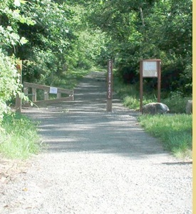
0.00 From the Edison lot, the rail bed parallels Edison Road heading south. Follow it from here.
0.30 The rail bed crosses Edison Road. A short distance into the woods, the remains of the turntable pit are off to the left
0.68 An ATV path joins on the left
1.95 The rail bed emerges behind a private home. Please respect the private property and do not trespass. Check the map for Sparta Mountain Wildlife Management Area and seek a route to circumvent the private land. The rail bed ahead is part of the private driveway.
2.05 The rail bed crosses Glen Road and continues on private land parallel with the road. Hikers will have to follow Glen Road parallel with the rail bed, and turn left on Milton Road.
2.15 A house is built on the right of way, visible from the road. The rail bed then continues behind more homes on Glen Road.
2.37 The rail bed crosses a beautiful stone culvert over Milton Road and enters state land once more near the site of former Mahola Station.
2.64 After passing between two homes, the rail bed crosses Hayward Road. This section is reportedly public land, but the land owners dump material onto the right of way and try to make it seem private. Ahead, the rail bed is well used as a trail. See Weldon Brook WMA map: http://www.nj.gov/dep/fgw/pdf/wmamaps/weldon_brook.pdf
3.60 The rail bed crosses Pine Swamp on a fill.
4.10 The rail bed passes near Weldon Brook Lake
4.32 The rail bed crosses Weldon Road in Mahlon Dickerson Reservation
4.50 The rail bed here is on a fill above Saffin Pond
4.62 The Saffin Pond dam is to the left. The Highlands Trail follows the rail bed for a time. Ahead, the Highlands Trail departs to the right, crosses Weldon Road and follows Winona Trail. The rail bed ahead passes by monuments from when it was used as the entrance to some estate.
5.34 The rail bed crosses Weldon Road again, and becomes very undeveloped on the other side, first parallel with or under the road.
5.65 The rail bed begins turning away from Weldon Road
5.70 The rail bed leaves Mahlon Dickerson Reservation. Hikers should leave the rail bed if they have not already, and make their way back to Weldon Road and walk south. The rail bed continues on private land.
5.83 The rail bed passes close to a shed behind houses. It then passes beneath overhead wires.
5.95 The rail bed crossed Weldon Road again in this area. It continues south and looks to be mostly obliterated. It is likely that Pathfinder Trail and Shawnee Trail are constructed on it's route. After crossing current Rt 15 it probably ran close to Venetian Drive. Hikers wishing to continue should turn right on Weldon Road south. There is really no good access to these roads by walking; they would have to be out and back hikes with little to see. In addition, crossing Rt 15 would require returning to Weldon Road anyway. On the other side, Weldon Road becomes Espanong Road.
8.10 Former railroad bridge site over a small leg of Lake Hopatcong. The bridge site can be seen rather clearly from Espanong Road.
8.27 Brady Road is on or near the former rail bed. It continues and probably is now part of East Shore Road for a bit.
8.74 The probable rail bed turns off of East Shore Road onto Spring Road. It then probably follows McNabb Road. It probably passed through what are now yards and then used Nolan's Point Park Road, followed by Cove Road, followed by Stonehenge Road. Many of these roads to not appear to directly connect, and even though some may have informal pedestrian connections, they need to be explored more accurately by Metrotrails. The most direct through route for hikers would be to take Castle Point Road to Nolan's Point Road and turn left. Follow that to Espanong Road again and turn right. The rail bed passes in part through Minisink County Park as shown on the maps, but there does not appear to be a good access from the north. Metrotrails has not yet scouted this short section, instead opting to follow Espanong Road to the next section in Berkshire Valley WMA.
Nolan's Point was the original terminus of the Ogden Mine Railroad. It was here that ore was transferred from rail cars to boats operating on the Morris Canal.
10.35 The railroad probably crossed Espanong Road at this point.
10.53 The rail bed comes close to Mase Road but is inaccessible.
10.60 The rail bed crosses a small stream. Ahead, it is shown on maps as part of Minisink County Park, but appears to be inaccessible.
10.98 Rail bed reaches a private yard. It then follows a driveway
11.09 The rail bed crosses Minnisink Road and becomes accessible once again. Pass around the outside of buildings across the street, Jefferson Township Public Health. The Central Railroad of New Jersey constructed the Lake Hopatcong Railroad in 1882 to eliminate the need to transfer iron to barges for the Morris Canal at Nolan's Point. The railroad had to overcome more than 300 feet of elevation to make this possible.
11.20 Enter the woods on the rail trail. Soon an above ground pipe follows it's route. The trail skirts the edge of Mount Arlington on the right, on a high shelf.
11.80 A woods road crosses the rail bed
12.14 Woods road crossing
12.90 Wide access to the left leads to Berkshire Valley Road
13.54 The trail section ends at Gordon Road. To the right in a short distance is a parking area for Berkshire Valley Wildlife Management area. The rail bed goes onto private land ahead. It passes through a yard then re-enters woods parallel with a cul de sac known as Country Lane. Hikers should turn left on Gordon Road to Berkshire Valley Road and turn right.
13.80 The rail bed emerges at some sort of a truck operation place. It is used as the access road.
13.98 The road turns left probably away from the rail bed to Berkshire Valley Road.
14.05 The rail bed crosses Rt 80, no sign of it here. Hikes will be on Berkshire Valley Road just to the west and pass beneath Rt 80 at the underpass which is shared by former Wharton and Northern Railraod.
14.12 Crossing Berkshire Valley Rd, near the junction site. The rail bed crossed near a small creek underpass.
14.17 The rail bed joins the abandoned Wharton and Northern Railroad wich tracks still in place. Please do not trespass, this section of the rail line, while proposed, has not been converted to a trail. No parking is available at the southern terminus. The closest parking was for Berkshire Valley WMA on Gordon Road.
Hosting courtesy of Firebrand Communications. Website design by SGF Studios
©2012 Metrotrails unless otherwise noted • All rights reserved