Long Distance Trails – Perimeter of New Jersey


NEW YORK/PHILADELPHIA METROPOLITAN AREA
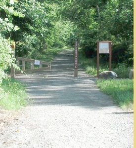
OPEN SPACE RESOURCE LIBRARY
Hiking the Perimeter of NJ; An Amazing Undertaking
One of the great goals of Metrotrails is to hike the entire perimeter of the state of NJ, an undertaking which perhaps no one has ever done recreationally.
Hikers tend to set these amazing goals, and all too often it is to complete the Appalachian Trail, or the Pacific Crest Trail, or to summit Kilimanjaro, all great achievements. But we have moved toward something different, from the very beginning, trying to connect each hike with one completed previously. I recall setting short term goals, like reaching the NY line, different towns, different trail systems. One of these goals was to reach the ocean. The goal was easily met, but what to do when we got there? Our first view of open water on the hikes came in Sadowsky Park in Perth Amboy. This simple achievement, having walked a line from my home to the water was already something that surely no one in my home town of Washington had ever done (or even wanted to, but I didn't care). What would come next?
We would begin heading both north and south. We would follow the Arthur Kill to the mouth of the Hudson, then follow the Hudson from there. To the south, we would cross the Raritan at the first convenient point and follow the bay, then the ocean south to the tip of Cape May.
In the following years I would see New Jersey in a way that only my fellow hiking companions could relate; beautiful beaches, rolling dunes, tidal marshes, brackish estuaries, long forgotten piers, thriving industries, million dollar homes and simple cabanas, light houses, giant ships....
The "jump off point" for these descriptions will be the west end of Sadowski Park in Perth Amboy. From here, hikers may head north along the industrial corridor with it's ports, back streets and pocket parks, or head south to follow the bayside beaches and eventually follow the Atlantic Ocean south. Both routes will often require sections of road walking to make connections. Some sections will follow developed trails while others will simply be along the beach with no developed route. There are places where the beach is privately owned, and the rocks make it nearly impossible to walk. Please respect the rights of private property owners.
Northbound...
0.00 Second Street, the beginning of the path along the beach in Sadowsky Park, Perth Amboy. GPS lat: 40°30'2.35"N long: 74°16'37.10"W
0.13 Access point to the left. There are tennis courts out near Sadowsky Parkway
0.20 A dock reaches out onto the bay with fantastic views, worth the side trip. Another access leads left.
0.35 Very nice war memorial on the left, followed by another access
0.40 Another access path to the left
0.48 Another dock reaches out onto the bay, this one curving. There is another access to the left.
0.52 The path turns away from the waterfront slightly. A jetti reaches out into the mouth of the Arthur Kill with lovely views
toward Staten Island.
0.60 Reach a spot close to Water Street. Continue on the path along the waterfront. It passes below a concrete wall.
0.75 An attractive looking boat house building on the left. Continue along the path ahead.
0.80 The path turns right and changes look. You will soon be along the edge of a parking lot, keeping with the waterfront.
0.85 The path turns left along the waterfront north.
0.93 Another building on the left. Continue to the right of the building and reach a dock going off into the Arthur Kill to the
right. It is worth the walk to head out onto it, and it may look like it is a through route, but is not. It leads to a dead end
out on the water. Another floating dock does similar from the other end. Through hikers should turn left after the
building.
0.97 Reach a wide sidewalk and turn right along the dock areas to the north.
1.05 The lovely steps going up into Bayview Park are directly to the left across the parking lot.
1.12 Turn slightly left and continue along the waterfront north. Here, the northern floating dock goes out onto the water,
similar to the one seen earlier. It too dead ends.
1.17 A ship's steering wheel is designed into the pavement. Walk across it and turn right onto Front Street north behind the
building. Front Street ahead is lined with many parking spaces.
1.33 Walkway diverges from Front Street once again along the northbound waterfront.
1.45 The walkway ends at Commerce Street. Plans are underway to extend to the north. Please be prepared for updates to this
guide. Construction in this area may inhibit hiking opportunities. It is best to follow Commerce Street to Rector Street and
turn right.
1.60 Cross Broad Street along Rector Street
1.66 Turn left on Washington Street. Industrial ruins are along the right side of Washington Street.
1.72 Turn right onto High Street skirting the industrial site on the right.
1.83 A side street goes right along a large building. Turn here. If you miss the turn, make the next one on Buckingham Ave.
2.00 Reach the waterfront once again and turn left on the street.
2.07 Reach Buckingham Ave and the entrance to the next section of pathway along the Arthur Kill.
2.27 Excellent viewing dock leads out onto the Arthur Kill, worth the look! Giant oil tanks are visible to the north. This is why
the route must turn inland in this area. The path may be extended a bit to the north of this description, but for now turn
left to the four buildings, part of the Harbortown development. Pass between the third and fourth building on sidewalk
out to Great Beds Court.
2.44 Turn right on Great Beds Court, then immediately left onto Harbortown Blvd.
2.65 Reach a split in the road, and turn left onto Long Ferry Road. This road walk can probably be eliminated later on by
following developed paths.
2.76 Turn right on High Street and cross an abandoned railroad crossing.
3.00 After crossing an industrial side road, pass beneath the Outerbridge Crossing, a huge bridge across the Arthur Kill
connecting Perth Amboy with Staten Island. It carries Rt 440. The view into the arches of the piers from underneath is
interesting. Continue along High Street around industrial areas. Not the most pleasant area to walk. There may be
abandoned rail lines beside the road that have been open enough in the past to walk.
3.50 Reach County Rd 611 and turn right. Ahead is the stereotypical NJ most of America has come to know. Sprawling industry
and giant tanks abound.
4.07 Cross river and enter Sewaren. Look to the left of the road bridge an an old weighted railroad bridge. More NJ stereotypes
ahead.
4.55 Reach a park, and the NJ stereotype ends. Walk through the grass through the center of this narrow park with Ferry Street
parallel to the left.
4.66 Large parking lot. Cross parallel with Ferry Street.
4.76 Ferry Street to the left intersects with Cliff Road. Ahead is a lovely area out on the Arthur Kill, an excellent viewing area.
Walk out onto it and follow the paved path around it's edge back to Cliff Road, which it runs along. Many views continue
from here along the Arthur Kill.
5.10 Parking area to the right with a boat dock. The pathway on the right ends. There is a sidwalk on the left side of the road.
Across, Alvin P Williams Memorial Park is visible. It is not convenient to visit as part of a through hike, but could be a very
attractive side trip. Continue through residential area.
5.50 Cliff Road begins to parallel the railroad tracks to the left. They are up on a fill.
5.80 Debra Place on the right leads to the aforementioned park
5.90 Another road heads to the right. Pass beneath many overhead wires.
6.05 Pass through more tank farms.
6.50 Former grade crossing of the railroad tracks. Port Reading Ave is on a bridge to the left. Cross the tracks and turn left
under the bridge. It is not worth trying to get on the waterfront at this point, as it is full of industry and is currently
inaccessible. Instead, continue to Renewal Way in Carteret on the other side of the bridge, then continue straight on
Carteret Street.
7.00 Reach a swath of grass to the left of Carteret Street, a park. Walk in it heading north.
6.75 Where Third Street turns away and Carteret Street ends, cross the wider park on a diagonal out to the right, to Fourth
Street.
6.85 Turn right on Fourth Street
6.90 Turn left on East Tappan Street, or parallel it through park and ball fields to the right of the road. Turn right at the end on
Dawn Drive, go two blocks and reach Vernon Way.
7.30 Turn left on Vernon Way, then right on Birch Street for three blocks.
7.62 Turn left off of Birch Street onto Marion Street and go to Coolidge Ave, about nine blocks.
8.04 Turn left on Coolidge Ave for a few feet, then immediately right onto Jersey Street.
8.11 Reach Carteret Ave and cross into a park. Turn right in the park heading southeast.
8.30 Reach a lovely pond in the park. Skirt the edge and follow a path around the edge of a circle. Continue to the left parallel
with Cypress Street, and eventually exit onto Cypress Street at the east side of the park near the intersection with Louis
Street and Washington Ave. Turn slightly left and head north on Washington Ave.
9.10 After a large residential section, begin passing large retail places on the left. Continue ahead on Roosevelt Ave. There is
no real good crossing for the New Jersey Turnpike Ahead. There are railroad tracks that head north parallel with them on
the east side, and an excellent underpass with a good walking route at the Rahway River, but it is illegal to walk the
tracks to this point. Instead, hikers should follow Roosevelt Ave across the Turnpike.
9.70 Cross NJ Turnpike
9.87 Turn right on Post Blvd.
10.30 After about eight blocks, reach Joseph Medwick Park, where there is parking on the right side. Post Blvd becomes a nice
walking path through the park.
10.37 The walkway section begins after another parking area. The path begins to follow the Rahway River. To the right, an informal path leads beneath the NJ Turnpike and ends at the railroad tracks, where there is a lift bridge. Continue on the path to the left.
10.70 The path begins to turn away from the Rahway River. Ahead, there is a giant pipe which crosses the wetlands, and ends at an industrial building on the end of Mileed Way. Many people walk along the top of this big pipe and use it as a trail, but it is not a legal public route.
11.00 Large parking area on the left. The path splits off to the left ahead twice. The second one leads to Pauline Street. Continue on the path to Dalbert Street. Turn right, then immediately left through a mobile home community, then left again at the curve to reach Roosevelt Street. If preferred, hikers can head south and follow Pauline Street to Roosevelt.
11.33 Turn right on Roosevelt Street.
11.50 Pass Mileed Way on the right. The name of the street changes to Randolph Ave.
11.75 Turn right on Hart Street
11.94 Turn left on East Hazlewood Ave.
12.10 Cross Witherspoon Street.
12.36 Turn right on Woodbridge Road and cross the Rahway River.
12.45 Parking on the right. There is a section of Rahway River Trail to the right here, but it is not a through route. It passes
close to the river and offers excellent views. It also crosses board walks. Unfortunately, there is only one way in and out
of this park, so it must be an out and back. Still, the short hike is worthwhile. The out and back would total an additional
0.8 mile. Continue ahead and pass beneath Rt 1. The Rahway River Greenway, an extensive trail system can be hiked
north from here. Although it is rather broken up, it is pretty easy to follow. See Rahway River Greenway; Long Distance
Trails. Continue north to Washington Street.
12.90 Turn right on Washington Street
13.23 Turn left on Paterson Street and cross Grand Ave with a diagonal
13.40 Large parking lot on the right. It is possible to cross the parking lot and then skirt the south side of another parking lot on
a paved path, after a grassy area to avoid the road.
13.66 Return to Paterson Street
13.75 Another paved path turns away from Paterson Street, follow it as it borders a retention pond
13.93 The paved path begins to loop back around the retention pond away from Rt 1. Turn right and follow Rt 1, West Edgar
Road under railroad tracks
14.10 Pleasant Street on left. Linden Airport is to the right.
14.67 Reach Stiles Street. To the left from here is a park. Turn and follow the park parallel with Rt 1.
14.82 Reach a creek. Turn left and follow it up stream.
14.89 Foot bridge over the creek, cross and follow the paved path which leads out to parallel Wood Ave.
15.09 Turn left and follow Rt 1 and 9 north.
15.28 Woodlawn Ave crosses Rt 1 and 9. To the right, the Linden Cemetery begins, and is very nice to walk through.
Southbound...
0.00 Begin at the west end of Sadawski park, the boardwalk along the beach in Perth Amboy where the northbound mileage begins. Here, 2nd Street heads north. Follow it for about five blocks to Market Street, with the railroad tracks a short distance to the left. From the beginning point, the tracks can be seen crossing the Raritan Bay. Do not attempt to cross on the tracks. This would probably be considered a homeland security issue with heavy fines.
0.57 Turn left on Market Street across the railroad tracks. This was once the New York and Long Branch Railroad, built in 1875. It was jointly owned and operated by the Central Railroad of NJ and the Pennsylvania Railroad. Other smaller lines along the coast were incorporated into the line to bring it to Bay Head. This is now the route of the NJ Transit North Jersey Coast Line. It can be used to make many loop hikes in beach areas. Continue just over five blocks on Market.
0.63 Turn left on Grant Street into an industrial area and go a few blocks to it's near end.
1.08 Turn right on Patterson Street and travel three blocks with a vacant lot on the left.
1.23 Turn left onto a pathway along a brackish waterway to the right.
1.32 The path ends at Riverview Drive, a newer road. Turn left here with the bay across in view. A walkway leads directly across at a parking lot for more views out onto the bay, but it would be an out and back trip.
1.38 Another paved path diverges from the road to the left and follows the bay. Turn here.
1.66 The path ends at a parking area along Riverview Drive, very close to the new Victory Bridge. Turn left on Riverview Drive.
1.72 Pass beneath the new Victory Bridge. This bridge replaced the original Victory Bridge constructed in 1926, named in honor of World War I veterans. The original was a swinging bridge and caused both waterway and roadway traffic delays on Rt 35. The new Victory bridge was completed in two sections in 2004 and 2005. The 440 foot main span on the new Victory Bridge the longest precast cantilever segmental construction in the United States. After passing beneath the bridge, turn right as Riverview Drive parallels the bridge. There is a good sidewalk on the left side of the road.
1.92 Riverview Drive bends to the left, but continue straight along the grass parallel with the bridge it it's end. Hikers should then turn left onto the sidewalk along Rt 35 and turn onto the excellent walkway, on the west side of the new Victory Bridge and head south across the mouth of the Raritan River with excellent views.
2.30 Near center of the Victory Bridge there are views of the Raritan upstream. Unfortunately, the bridge does not afford much of a view of the bay side. The Thomas Alva Edison Memorial Bridge, completed in 1940, another former record holding span, can be seen upstream, with the Ells S. Vieser and Garden State Parkway bridges along side of it.
2.76 End of the Victory Bridge. Continue on the sidewalk with brackish wetlands to the right.
2.90 Cross some sort of access road. This section of highway is rarely walked, but the sidewalk is well made. A large open paved area is to the right with a building beyond.
3.12 Cross another access road.
3.20 Reach a crosswalk over an exit and cross. The sidewalk leads across an island of grass, then crosses the highway. Then cross another island followed by another crosswalk.
2.26 Turn right on the sidwalk, continuing on County Rt 684, with businesses around.
3.50 The sidewalk area along Rt 684 ends. Continue following the road along the shoulder. Use caution.
3.64 Where Raritan Street comes in on the right, there is a sidewalk on that side. Heavy traffic may prevent any crossing however. There is soon a median in the middle of Rt 684
3.95 The median in the highway ends, as does the sidwalk on the south side ahead.
4.05 Pass beneath railroad underpass. Ahead, pass through an intersection, and under two more road bridges and a railroad bridge all in very close proximity. Use caution in this area. The road enters the city of South Amboy after these bridges and there is a good sidewalk on the left side of the road. Some say South Amboy has more bars than anywhere else in NJ.
4.37 Turn left on North Broadway Street
4.57 A pedestrian overpass is to the left. Cross the tracks in that direction. Turn right at the end of the bridge heading southeast along the road. If you miss the turn off, continue and use the grade crossing on John Street.
4.67 Reach Augusta Street. There are two alternatives of about the same distance. Continue straight parallel with the railroad for three blocks and turn left on John Street, to reach North Rosewell Ave, or turn left on Augusta, then right on North Rosewell Ave to the intersection with John Street.
4.96 Corner of North Rosewell Ave and John Street. To the south is South Rosewell Ave, and John T. O'Leary Blvd continues to the left. Follow John T. O'Leary a short distance on the left side of the road.
5.04 An access drive is on the left. Turn here it leads into a bayfront boat launch. To the right of the parking area is the beginning of a nice paved pathway out along the bay. Follow the walkway. If for some reason this access point is closed, instead turn the next left on Raritan Reach Road through a development, and after a short distance a sidewalk leads between two homes out to the walkway.
5.25 There is a very nice section of beach to the left. The pathway from Raritan Reach Rd comes in on the left. Hikers will have the choice of either walking on the beach or following the hard walkway. For the purposes of this guide, we will give mileage along the walkway for now.
Along the bay, there are constant views across to Perth Amboy, Staten Island, and the Outerbridge Crossing. The bayside will often be scattered with thousands of snails where tributaries enter, and the interesting looking razor clams.
5.31 Another access from the development on the left.
5.36 Parking area on the right. More good beach on the left.
5.43 Another access on the right
5.60 The paved path crosses a bridge over a small stream. It then enters Raritan Bay Waterfront Park, a Middlesex County Park. The pathway changes to a blacktop surface and turns to the right into the park where many paved paths loop around. Continue following the waterfront. There are rocks and such, and a narrower section of beach.
5.80 The beach leaves the park area and becomes more secluded.
6.12 A stream enters the bay here. This is a wet crossing. No convenient bridges are close by, but where the stream enters the bay, even at high tide, it remains rather shallow. It is a long walk out and around to avoid this crossing. Please refer to a map for nearest possible road alternatives.
6.44 The NJ Transit Tracks come very close to the bay here, one of the most scenic points along the ride. Hikers will need to continue along a stony slope along the bay in order to continue.
6.77 A section of beach resumes, and the railroad tracks turn away from the bayside. The Rt 35 overpass is in view, in the town of Morgan. There may be a very small wet crossing in this area. Continue along the waterfront, which begins to have some grasses and weeds growing along it. There is a wooden piling leading out to the water in view ahead. Walk toward it.
6.86 It is visible where people step up onto the wooden piling. It may be difficult, but climb to the top, and carefully walk out to the water at the corner of the piling.
6.89 A ladder leads down the piling very close to the water. During high tide, this route may not work. Descend on the ladder and continue along the waterfront.
7.00 Reach Cheesequake Creek where it enters Raritan Bay. Cheesequake State Park manages much of the wetlands, but accessing the park from this point is not feasible. It is not possible to walk the edge of Cheesequake Creek is it passes through all estuarine wetlands between here to the developed part of the park. Turn right and climb to the Rt 35 bridge to cross the creek. Pratt Avenue once crossed the creek next to the current Rt 35 bridge. The former bridge site is visible.
7.10 Center of Rt 35 Cheesequake Creek bridge. The former New York and Long Branch Railroad bridge is visible to the south. At first opportunity, turn left off of Rt 35 and back to the other side of Cheesequake Creek along Pratt Avenue. Once at the former bridge site again, turn right and head out to the bay.
7.40 Reach the bay, and turn right continuing along Morgan Beach.
7.57 There is a parking lot on the right above the beach, and a stony section of waterfront. Another paved pathway follows the bay here, and so mileage continues along that. This is part of Old Bridge Waterfront Park, another Middlesex County Park.
7.74 Unpaved access to Cliffwood Way. Paths diverge ahead. Unpaved path leads down onto the beach, paved path continues along the bay. There is a long walkway leading out onto a jetti offering excellent Raritan Bay views.
7.82 The bayfront walkway becomes a very interesting elevated walkway.
7.93 Access to the right leads to Shoreland Circle. To the left is a beach access ramp.
8.02 Another jetti with a walkway heads out onto the bay
8.15 The elevated walkway ends at a parking area in Laurence Harbor. Another jetti with a walkway heads out to the bay. Continue left past the parking area along the bay, and the sidewalk becomes blacktop path. The beach ends and is a stony slope to the water, so walking the path is more desirable.
8.25 Playground on left
8.47 Another paved path goes right, to a parking area accessed from Bayview Drive, which the main path also passes ahead.
8.58 Another split in the path. Both paths come back together shortly. The one to the right is more direct, the one to the left has two viewing points to the bay.
8.58 The paved trail crosses Margitt's Creek on a nice foot bridge.
8.73 The paved pathway ends. Straight, a sand path leads to an access path out to Rt 35. It is best to turn left through the clearing out to Seidler Beach and continue following the bay.
9.05 A larger water break than the previous few onto the water. Continue ahead on Raritan Bay Beach.
9.26 Stony piling on right, and the beach sort of disappears. Climb here to more paved paths and continue parallel with the bay. The path also runs further away from the bay.
9.32 A board walk leads off to the left. Turn here.
9.38 A widened viewing area offers good views of the bay.
9.44 End of the board walk. Turn left at the paved access road, and soon parallel the left side of a large parking lot. Follow the parking lot to the end and continue right out to Rt 35.
9.60 Turn left along Rt 35 to cross the Whale Creek. Enter Monmouth County.
9.65 Turn left from Rt 35 into a parking lot. Continue across parallel with Whale Creek, then follow unpaved beach access out to the bay.
9.73 Reach Cliffwood Beach. It can be followed a short distance to the left where there is a large stone jetti at the mouth of Whale Creek. Continue to the right along the bay, the nicest section of beach so far.
10.05 The beach ends. A pathway slightly inland leads to Marshall Concourse Drive above Treasure Lake. The best hiking route though is to continue along the top of the sea wall to the left. Many fishermen use this area.
10.57 Developed access point to the right, with parking for maybe four cars. Continue on the sea wall which becomes less like a walkway.
10.70 Matawan Point. Beach Drive is to the right of the sea wall. To the east is Keyport Harbor, where the Matawan Creek enters Raritan Bay. It is possible to continue walking the sea wall south, but it would have to be an out and back trip because there is no possible access to the south. Metrotrails scouted this section in 2006, and all paths dead end. Still, it is worthwhile to continue for the views. There is a dramatic opening in the sea wall that can be used for a return route, leading to the end of Beach Drive.
To continue, follow Beach Drive to South Concourse and turn left, heading west.
10.94 From South Concourse, turn left on Sylvan Way through a residential area.
10.98 Turn right on Maiden Drive
11.14 Keep to the left when Maiden Drive continues straight, or continue on Maiden Drive. Both routes lead to Prospect Drive.
11.40 Continue on West Prospect Drive to the left.
11.75 Reach Amboy Road. Turn left.
12.07 Cross Matawan Creek. The road changes names to West Front Street.
12.40 Cross Luppatatong Creek on the West Front Street.
12.45 Turn left across a parking lot to reach the edge of Keyport Harbor.
12.50 Turn right and follow a walkway along the harbor, along parking lots.
12.60 A dock heads onto the harbor for more views.
12.71 Large parking lot on the right
12.83 Large boat launch. There is a bit more walkway on the other side, and a little section of beach, but not a through route. Hikers will have to continue out to Broad Street to the south and turn left on First Street. Cross to the other side and then turn left onto beach at the end of the walkway.
12.90 End of the walkway. Follow the beach and stay as close to the water as possible as not to intrude on any private land.
13.08 Reach a small parking area. It may be necessary to head out to 1st Street for a time, if that hasn't happened already.
13.11 Turn left on 1st Street in Keyport.
13.28 Turn left on Prospect Street.
13.33 Turn right on East Front Street
13.39 With Myrtle Ave on the right, it should be possible to walk across open area to the left toward the waterfront.
13.45 The end of Cedar Street reaches the waterfront, with ball fields and courts at a small park. Continue along the shore.
13.90 Grassy tufts along the bay side, with sandy area to walk to the right.
14.05 It is necessary to wade across the outlet of the Chingorora Creek here. When scouted by Metrotrails in 2006, it was curious to find that the creeks are often very shallow where they reach the bay, but extremely deep a short distance in. Use extreme caution nevertheless.
14.32 A path access to the right leads to the corner of Chingarora Street and Edmond Ave in Union Beach.
14.50 Cross an estuary and continue. It is not very deep. Tufts of grass along the shore look absolutely incredible. There is also much drift wood, and the shell of an old boat along the shore here.
15.00 Reach Conaskonk Point, the northern tip of the peninsula north of Union Beach, with excellent views across the bay. The Verrazanno Narrows Bridge begins to come into view in the distance.
15.15 Cross estuary again
15.32 With an access to Front Street in Union Beach on the right, the beach front is beginning to widen and look more developed.
15.63 AT jetti out onto the bay, it is necessary to climb to a walkway along the street above.
15.68 It is necessary to go around a couple buildings here along Front Street, then return to the walkway along the waterfront, with parking on the right.
15.93 Pass a small park on the right with limited parking
16.00 The walkway turns inland a bit to Union Ave. Climb down and follow the waterfront.
16.10 Reach Flat Creek. It is possible to wade this creek, but not practical. Beyond, when scouted by Metrotrails, we found that we could walk the shore line further, wade across East Creek, and then reach Waackaack Creek. Waackaack Creek was too difficult, and had a strong pulling tide, so is not recommended. The best route is to turn right and head out to Union Ave.
16.21 Reach Union Ave after following a path and crossing a paved lot. Turn left and follow Union Ave south for about seven blocks.
16.54 After crossing Columbia Ave, reach the Henry Hudson Trail, a paved rail trail built on the former Bayshore Branch of the Central Railroad of NJ, and turn left.
16.80 The trail crosses the outlets of East Creek with views out to the bay beyond.
17.08 Cross Rose Lane
17.30 Cross an access road near Natco Lake.
17.47 Cross Thornes Creek on a decked former rail bridge.
17.66 Cross Central Ave.
17.80 Reach Laurel Ave and turn left.
18.12 Cross Waackaack Creek on the road bridge
18.28 Parking lot on the left as the road changes names to Beachway Ave in Keanesburg. Follow a beach access path at the left side of the parking area. A boardwalk also meanders through the dunes a bit further to the east.
18.40 Reach the beach. It can be walked to the left a bit, to the outlet of Waackaack Creek, but that would have to be an out and back. Continue right on the beach.
18.76 A long dock leads out onto the bay. It is nearly a half mile long!
19.00 Point Comfort. A stone jetti reaches out onto the bay. Continue on Ideal Beach.
20.95 Reach another creek entering the bay. Turn right and head out to Port Monmouth Road passing parking along the way.
21.13 A paved trail to the right leads to Henry Hudson Trail
21.20 Cross the creek on the bridge
21.40 Where possible turn left off of the road out to Old Port Monmouth Road.
21.45 At the old Port Monmouth Road, turn left. Continue to near the end where access to the beach is on the right. Follow it out to the bay.
21.60 Reach the bay, turn right heading east.
22.10 Large dock pier out onto the bay. Parking. Continue east.
22.60 Elevated wave breaker along the beach
22.72 Reach a beach access walkway. Although it is possible to walk a bit further, there is no way across another creek entering the bay, and would require turning around. Turn right onto the walkway exiting the beach.
22.80 Turn right on Golden Eye Lane.
22.95 Turn left exiting the development to Port Monmouth Road and turn left.
23.00 Turn right on Church Street and cross wide wetlands.
23.36 Cross creek on bridge.
23.47 The road veers to the right and the name changes to Broadway. Church Street has been re-aligned. Continue across Broadway and south on Church Street. Across Broadway Church Street has been switched to a cul de sac. Follow sidewalk connection to continue on Church Street south.
23.80 Cross Campbell Ave. Continue on Church Street.
23.92 Reach the Henry Hudson Trail again and turn left.
24.13 Cross Main Street in Belford
24.30 Cross E Road
24.65 The trail closely parallels Rt 36.
25.25 Pass beneath the military owned and operated Normandy Road and railroad, for use by military personnel only. Then, turn left on Broadway Ave. An alternative route is to remain on Henry Hudson Trail to mile number 25.75 below.
25.50 Turn right on Central Ave
25.54 Turn left on Cedar Ave
25.65 Turn right on Burlington Ave. Florence Ave to the north is closer to the shore, but there is questionable access around the developments. Travel four blocks on Florence.
26.00 Reach Concord Ave and Leonardo State Marina. Leonardo was made popular by the "Jersey Chronicles", a series of popular films by Director Kevin Smith, many of which were set in Leonardo NJ. Follow the south side of the Marina
26.10 Turn left on Benton Avenue, then continue to the left following the waterfront
26.28 Beach access at the end of Beach Avenue. Continue to the beach.
26.32 Reach the bay and turn right
26.55 Turn right off of the beach and onto Beach Ave. Here at the ninety degree bend in the road is the former site of Conover Beach Beacon. Recent construction at the site may mean it is being replaced. It also makes walking the beach beyond this point impossible for now. Follow Beach Ave south.
26.62 Turn left on Burlington Ave, parallel with the bay.
27.00 Turn right on O'Neil St.
27.08 Turn left on Center Ave
27.25 Ball field on the left, and boat storage beyond.
27.34 Turn left on Avenue D.
27.40 Turn right on Bay Avenue.
27.68 Avenue A to the left provides a small beach access, but there is a stream outlet, so it is not an easy through route. Continue on Bay Ave.
27.75 Cross the stream and reach the Henry Hudson Trail. The Henry Hudson Trail is an alternative route to the mileage from 25.25 to 25.75. Turn left on the trail.
27.82 Cross West Ave, then reach 1st Ave, parallel it, and then cross. The paved trail continues along the backs of buildings, near a parking lot, and south of the harbor access.
27.95 Paved Henry Hudson Trail takes a jog to the left, then back to the right. It passes more parking and tennis courts, followed by boat storage.
28.26 The trail turns left at the end of the boat storage
28.30 The trail turns right away from boat storage lot and follows closely to the bay. It is possible to walk the narrow and sometimes rocky beach as an alternative.
28.60 The trail enters woods along the bay
28.87 Trail opens up to the bay again. There are steep slopes on the right, part of Mt. Mitchell, the highest point on the east coast between Mexico and Maine.
29.60 When the beach to the left begins to widen, turn left off of Henry Hudson Trail and follow the beach for a different perspective. Looking back at the slopes is quite beautiful. Going this way will however require returning to Henry Hudson Trail, so mileage continues on that trail from here.
29.68 The trail enters park area. It passes a parking area and then becomes part of Shore Drive. There are many points where sections of beach may be accessed off to the left, either in little pocket parks, docks, or informal accesses. Some are possible to walk through, some require climbing up the sides of docks. To stay right on the water, it involves countless back and forth walks along piers, many of which dead end. Also, some areas are open certain times, and closed others. To avoid any conflicts, the mileage continues on the Henry Hudson Trail and Shore Drive ahead.
31.22 Reach the corner of Shore Drive and Bay Ave. Climb to the right to the new bridge carrying Rt 36 over the Shrewsbury River. It replaced the original lift bridge demolished in 2010.
31.30 Begin crossing north side of Shrewsbury River bridge along Rt 36. Excellent bay and ocean views.
31.60 The foot of the former railroad bridge across the bay used to be visible from this point, but may have been destroyed in new bridge construction. The rail line travelled south along the coast to connect with the New York and Long Branch Railroad in Long Branch. Very little evidence of this line still exists today.
31.80 East end of the Shrewsbury River Rt 36 bridge. Begin heading south, and head to the beach at the earliest convenience.
32.00 If the beach has not been accessed yet, an access is at this point heading south on the path. Begin following the beach south at Navesink.
34.08 Large water break. Just ahead, Shrewsbury River Bridge crosses to Rumson on the other side of the barrier island. Continue south along the beach through Sea Bright.
35.25 The beach narrows quite a lot south of Sea Bright, and a large stone jetti exists. Climb it, or around it to continue along the shore.
36.35 After a long section of beach following close to Rt 35, the shore juts out with a large stone wall in Monmouth Beach. Continue south.
37.60 Public park on the right, with access point entering Long Branch
38.00 A jetti juts out onto the water at the same point as the beginning of the Long Branch boardwalk on the right. Both the boardwalk and beach lead the same place.

Hosting courtesy of Firebrand Communications. Website design by SGF Studios
©2012 Metrotrails unless otherwise noted • All rights reserved